


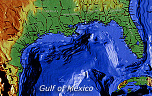

Scientists have been charting the bottom of the Gulf of Mexico off the coasts of Texas and Louisiana for three-quarters of a century. Hundreds of surveys have provided glimpses of different regions, in different levels of detail. But only recently did all of that work come together. Scientists from Texas A&M University compiled decades of work to produce sharp digital maps of the hidden sea floor.


 Your new post is loading...


This is an example of the amazing value the scientist at Texas A&M provide to our society.