
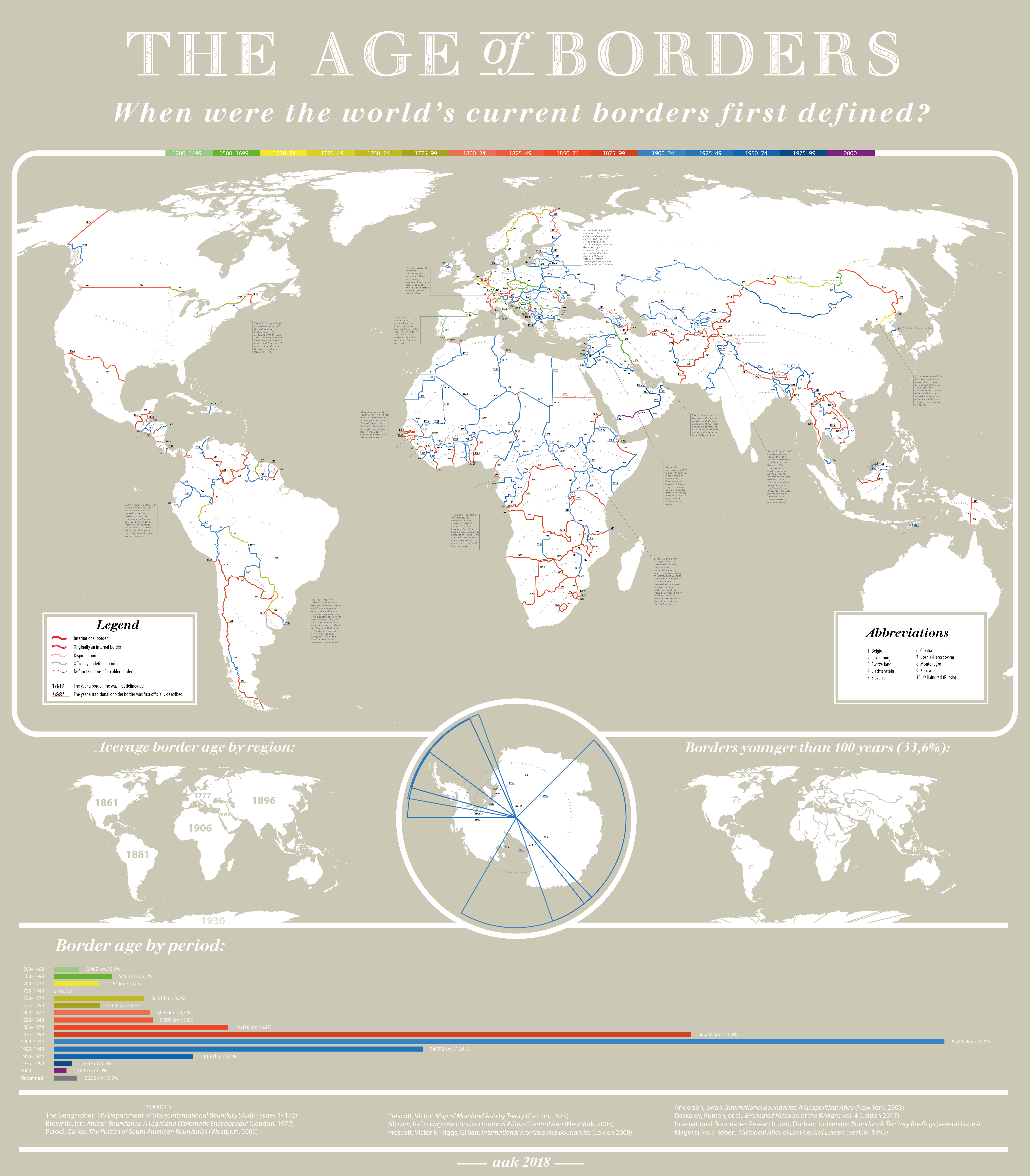

"The creation date of (almost) every international border. Full-size image here."
Tags: infographic, worldwide, borders, political, historical.
Get Started for FREE
Sign up with Facebook Sign up with X
I don't have a Facebook or a X account


 Your new post is loading...
 Your new post is loading...
Your new post is loading...
"The creation date of (almost) every international border. Full-size image here."
Tags: infographic, worldwide, borders, political, historical. 
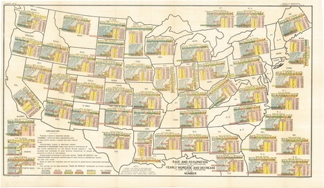
"Americans' understanding of who counts as 'white' has changed dramatically throughout the country's history and even over the last century alone. This map — which covers a decade of immigration to the US, from 1892 to 1903 — is a dramatic illustration of what it looked like when 'white' wasn't the same thing as European. Mouse over any part of the map to magnify it."
Tags: race, historical, USA, map.

Caterin Victor's curator insight,
November 10, 2014 8:43 AM
Up to me, race and colour don`t matter. Most important is the personality. America have now a black President. Is it better?? |
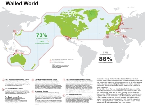
Accelerated through the fear from the attacks of 9/11 and all what followed, the so called ‘Western Society’ is constructing the greatest wall ever build on this planet. On different building sites on all five inhabitable continents, walls, fences and high-tech border surveillance are under construction in order to secure the citizens and their high quality of life within this system. The fall of the Berlin Wall was described as the historical moment that marks the demolition of world’s last barrier between nation states. Yet it took the European Union only six years to create with the Schengen Agreement in 1995 a new division only 80km offset to the east of Berlin.

Miles Gibson's curator insight,
February 13, 2015 11:04 AM
Unit 4 political geography This article explains how the world is filled with division and segregation. Some of the most notable are the walls are the wall in berlin, the wall/border/river/fence between the u.s. and mexico and the border between north and south Korea is the most notable walls. This article relates to unit 4 because it shows how people, through borders, have divided them through history creating new politics, culture and borders themselves. The political processes involved can change the policies and shapes of nations in the world. 
Monika Fleischmann's curator insight,
February 15, 2015 4:48 AM
Seth Dixon's insight:
This map shows that hi-tech political surveillance of borders is highly correlated with the core areas of the global economy and some of the most attractive immigrant destinations.
Questions to Ponder: What else do you see in this map? What does this say about the world order? Are there patterns that this map reveals/conceals?
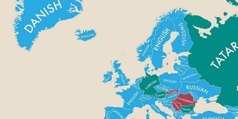
Some of these will surprise you.
Tags: language, culture.
Caterin Victor's curator insight,
November 7, 2014 2:35 PM
It is never a second language, my grandmother used to say : "As many languages you learn, is never to much, never enought".!! |


Preliminary - Political Geography