
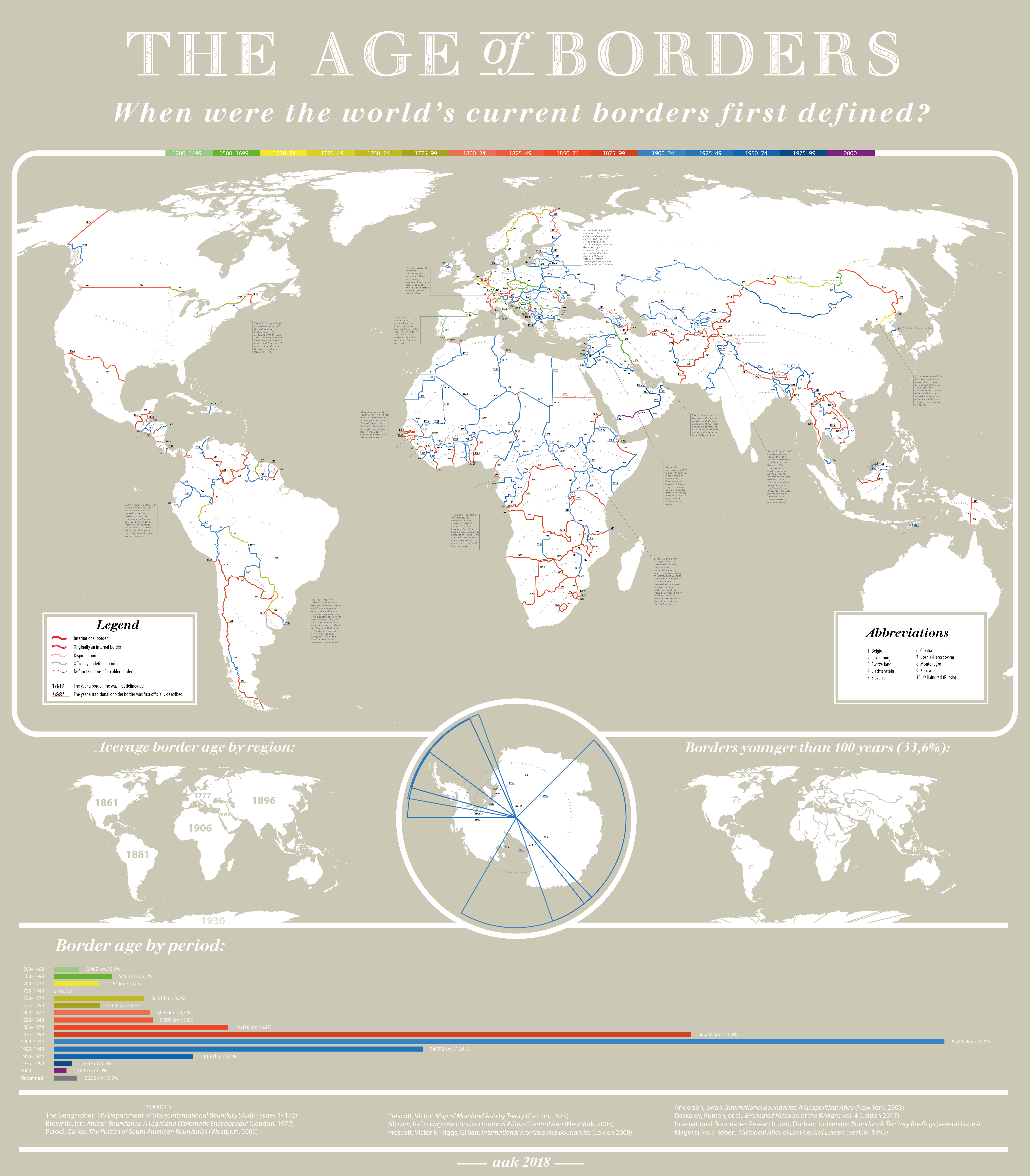

"The creation date of (almost) every international border. Full-size image here."
Tags: infographic, worldwide, borders, political, historical.
Get Started for FREE
Sign up with Facebook Sign up with X
I don't have a Facebook or a X account


 Your new post is loading...
 Your new post is loading...
Your new post is loading...
"The creation date of (almost) every international border. Full-size image here."
Tags: infographic, worldwide, borders, political, historical. 

"The battle between the Alamo garrison and Mexican President Santa Anna’s forces reads like a Shakespearian tragedy: greatly outnumbered, all the Texan defenders died. Even the men who surrendered were killed, fueling the outrage and critical mass required to swell the Texan army, become an independent republic, and in time choose to be annexed by the United States."
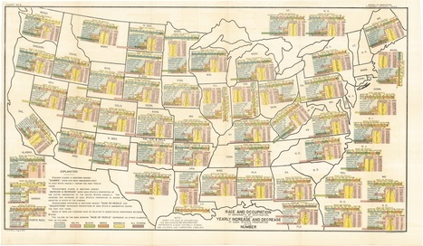
"Americans' understanding of who counts as 'white' has changed dramatically throughout the country's history and even over the last century alone. This map — which covers a decade of immigration to the US, from 1892 to 1903 — is a dramatic illustration of what it looked like when 'white' wasn't the same thing as European. Mouse over any part of the map to magnify it."
Tags: race, historical, USA, map.

Caterin Victor's curator insight,
November 10, 2014 8:43 AM
Up to me, race and colour don`t matter. Most important is the personality. America have now a black President. Is it better?? |
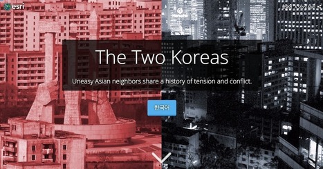
"While the Korean War of the early 1950s never formally ended, its aftermath has created starkly divergent worlds for those living on either side of the north-south divide. What follows is a look at life in the two Koreas; how such a night-and-day difference came to be; and where the crisis could go from here. Both governments claimed to be the legitimate rulers of the peninsula. Tensions between north and south gradually mounted, until finally, in June 1950, hundreds of thousands of North Korean troops stormed across the 38th parallel. The unsuspecting South Korean defenders were outgunned and outnumbered, and beat a hasty retreat southward."

Stevie-Rae Wood's curator insight,
December 9, 2018 9:10 PM
The two Koreas are polar opposites literally, North and South. The Korean war that took place some 68 years ago never formally ended because they could not come to peace agreements. So the border between North and South Korea known as the DMZ is the most heavily fortified border in the world because tensions still run high. The DMZ is the cease fire line. Both sides fear invasion, however in the current state of things it seems as if the North is more aggressive towards invasion that the South, as the South has found some secret tunnels and fear there's more by the North Koreans. Economically the North is severely behind in the world because of there dictators. While the South has become an economic Tiger thanks to the UN and USA trying to promote democracy in the area.

Matt Danielson's curator insight,
December 12, 2018 3:51 PM
The two Koreas are a great example of how Capitalism, Democracy, and liberty are far better than Communism. Just the difference in light visible from satellites at night in the two countries speaks volumes. The war being technically not over and only under cease-fire always leaves that chance for the conflict to reopen. Though today they are taking major steps toward peace and making moves that have never been done before. The amount of famine and overall sub quality of life in North Korea is mind blowing, and with much of it kept secret its hard to imagine how bad it really is.

Kelvis Hernandez's curator insight,
December 14, 2018 3:54 PM
For the two Korean nations, there are stark contrasts in the standard of living and wealth of the people. While the Korean war began in the 1950's it never formally ended a ceasefire was called and has just not flared up in a massive battle again. The two nations are uneasy with each other having different ideas for what Korea should be, but both nations do want a joint Korea. Looking at a map of the energy consumption by the two nations there is a line between those who have it and those who do not. These two have shown solidarity as well in the Olympics joining as one nation, but tensions will continue to flare for a long time.

"60 years has made a big difference in the urban form of American cities. The most rapid change occurred during the mid-century urban renewal period that cleared large tracts of urban land for new highways, parking, and public facilities or housing projects. Fine-grained networks of streets and buildings on small lots were replaced with superblocks and megastructures. While the period did make way for impressive new projects in many cities, many of the scars are still unhealed. We put together these sliders to show how cities have changed over half a century. In this post, we look at Midwestern cities such as [pictured above] Cincinnati, Ohio."

Sierra_Mcswagger's curator insight,
March 10, 2015 10:22 AM
In the above picture of Cincinnati, Ohio it is clear how much change American cities have undergone in 60 years. In the process of urban renewal these cities have been affected tremendously with the addition of new roads, businesses, and most likely the turning of land over to private developers. All previous land has been renovated and changed into the typical urbanized American city. S.S.
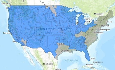
This interactive map, produced by University of Georgia historian Claudio Saunt to accompany his new book West of the Revolution: An Uncommon History of 1776, offers a time-lapse vision of the transfer of Indian land between 1776 and 1887. As blue “Indian homelands” disappear, small red areas appear, indicating the establishment of reservations (above is a static image of the map; visit the map's page to play with its features).

Tom Cockburn's curator insight,
June 24, 2014 5:51 AM
This will likely resonate with 'first peoples' everywhere |


Preliminary - Political Geography